Arlula has developed a system to standardise satellite imagery, which simplifies how space data is managed, processed, and utilised.
The availability of Earth observation data today is far greater than ever before – but the huge spread of different providers and formats involved in producing it is both a blessing and a curse. Third parties who want to access and use the data face a bottleneck that often involves dealing with multiple companies, expensive contracts, and processes that can take days. There’s considerable pressure to piece something useful together before the data gets out of date.
To help streamline the process, Sydney company Arlula has developed a system to standardise satellite imagery across different types of Earth observation (EO) spacecraft, with support from the Australian Space Agency. The set of tools, algorithms, and technologies can convert file types and other data into whichever standard a customer requires for analysis and machine learning. The result is image datasets with industry standards of interoperability, which can be used interchangeably among a range of scientific and commercial applications – such as agriculture, mining, and natural disaster management. The system was also developed through engagement with CEOS (Committee on Earth Observation Satellites), an organisation working to promote international EO standardisation.
Arlula’s global customers include the Japanese government, the US Space Force, and multiple governments in Europe. By making remote sensing data easier to use, Arlula hopes to create opportunities for new applications and businesses to engage EO technology, increasing its uptake worldwide. Meanwhile, the company’s interoperable data offerings are enhancing its own machine learning and AI models through more consistent and optimised inputs.
Australia Wind Power from Earth as Art 4 exhibit, Landsat 8 image.
Credit: United States Geological Survey
Access to satellite imagery is no longer the constraint – speed and reliability are… We are eager to showcase Australia’s capabilities in space technology and contribute to the global landscape of innovative data solutions.
~ Sebastian Chaoui, co-founder and CEO of Arlula

Technology features
- Automated normalisation of multi-source EO data, producing consistent, analysis-ready imagery across different satellite providers.
- Data source-agnostic processing infrastructure, enabling seamless integration of imagery from diverse EO spacecraft.
- Scalable generation of analysis-ready EO data to support repeatable scientific, operational and commercial applications.
- Designed to support advanced analytics and machine learning, reducing technical barriers to using satellite data.
Pictured above: The Arlula team at IAC 2025 in Sydney. Credit: Arlula
Project highlights
- Agency Moon to Mars grant awarded to develop the system.
- Delivered an end-to-end platform for processing and distributing normalised EO data, addressing a key interoperability challenge in satellite imaging.
- Demonstrated cross-satellite standardisation, enabling practical applications across agriculture, mining, and disaster management.
- Progressed integration of supplier workflows toward globally recognised data standards, improving consistency and quality across EO supply chains.
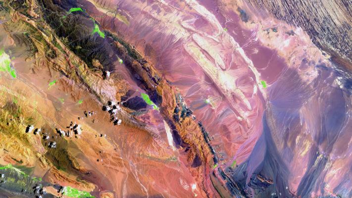
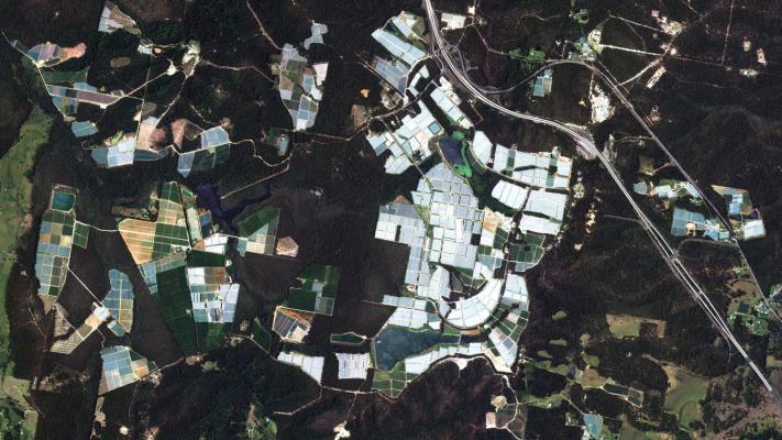
Pictured above: Example EO image. Credit: Arlula
Industry showcase
Australian space innovations making an impact.