Whether we call it the Moon in English, markeri in Ngarrindjeri (South Australia), or merrk in Murrinhpatha (Northern Territory), its glow connects us under the same sky.

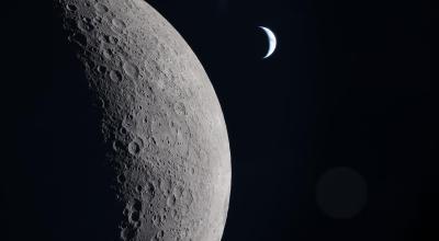
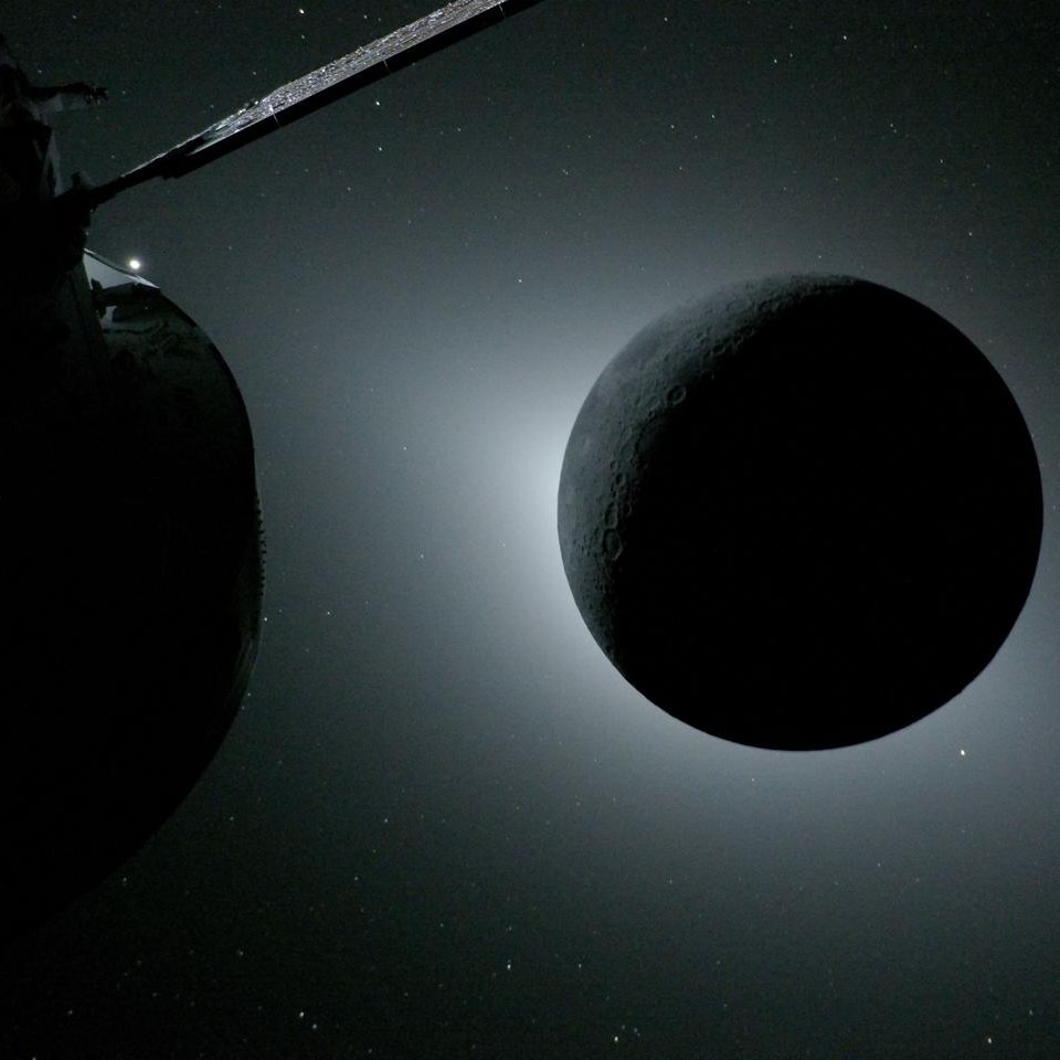
Now, our celestial neighbour is back in the spotlight, with Artemis II capturing breathtaking close-up images from humanity’s first crewed lunar flyby in more than 50 years.

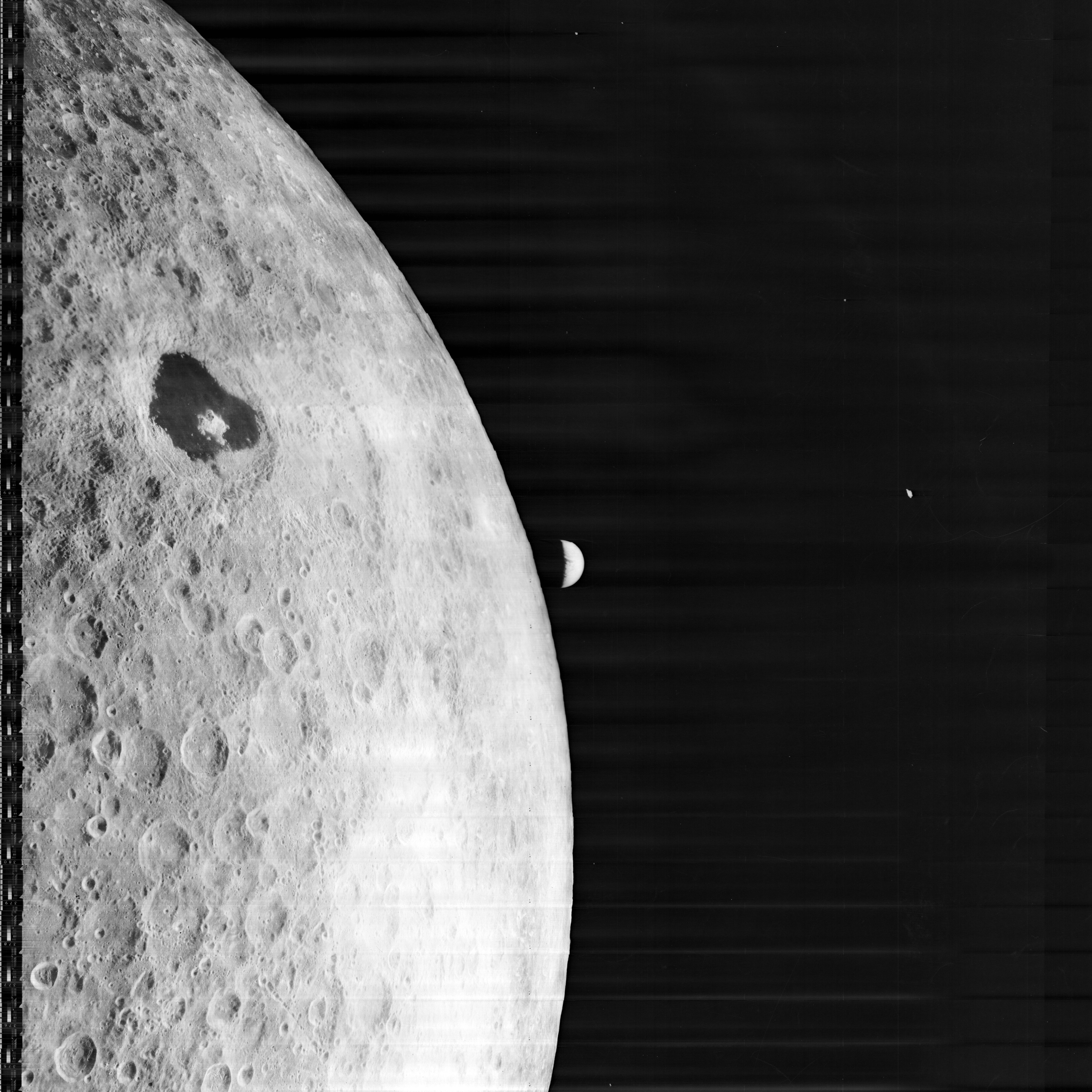
These remarkable photographs reveal details that even the best Earth-based telescopes cannot capture – from rugged craters to sweeping lunar landscapes shaped over billions of years.

The renewed excitement comes as NASA this month announced the Artemis III crew for a 2027 mission that will test key systems needed for future lunar exploration.

For Australians watching from Earth, they are a powerful reminder that every generation of lunar imagery has brought the Moon closer – and helped place the next era of discovery within reach.

Photo essay

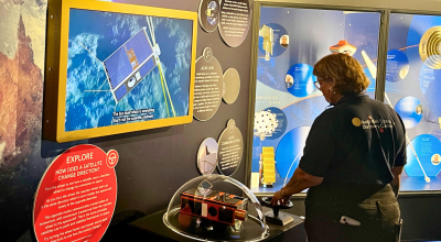
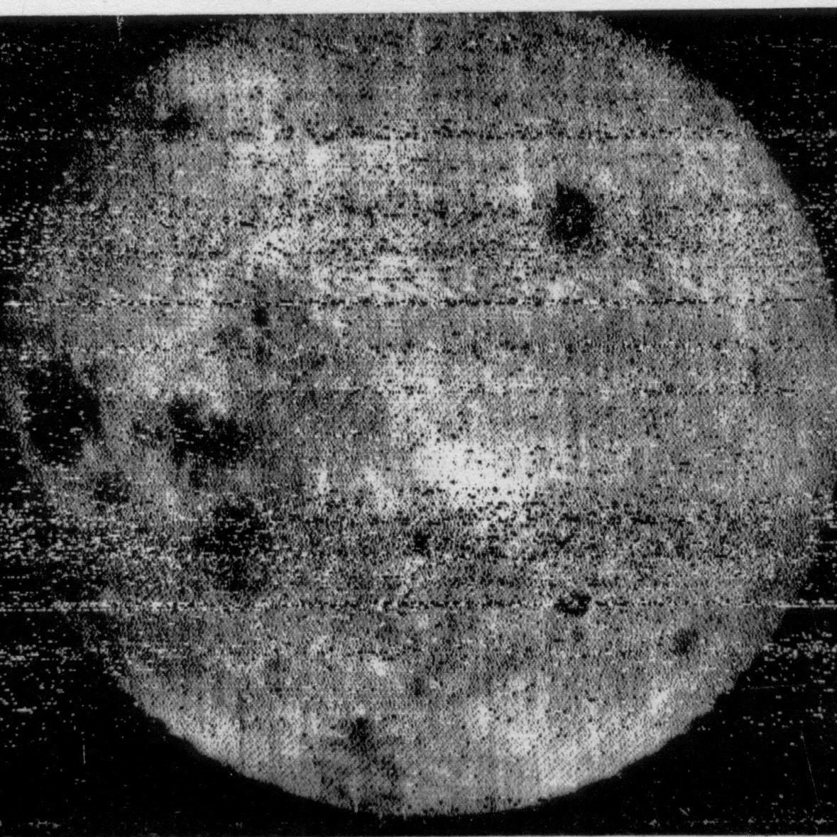
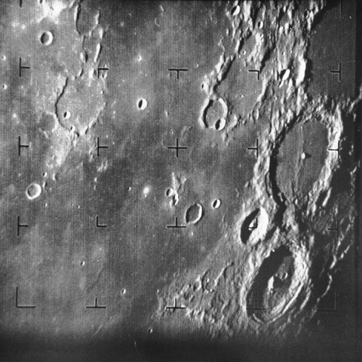
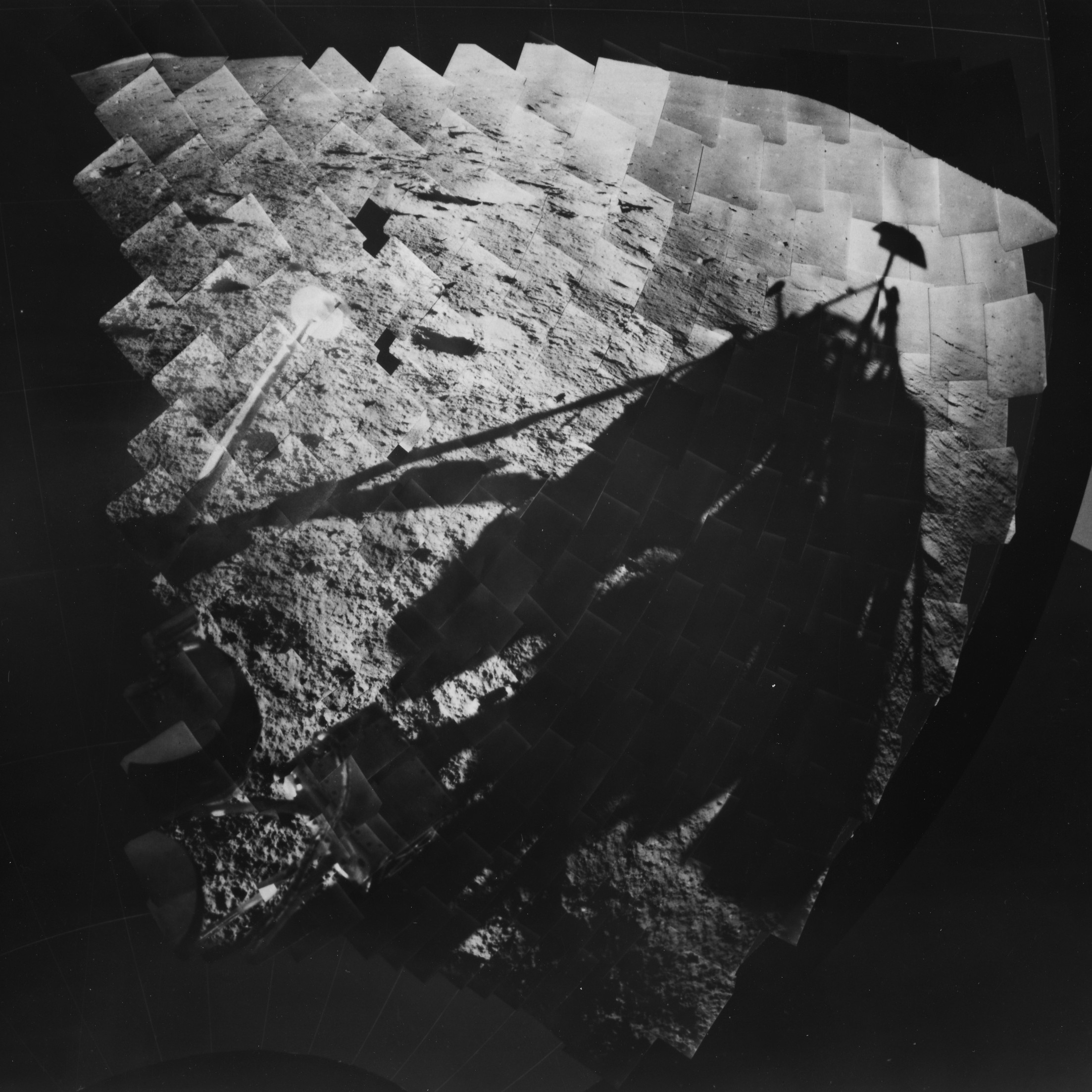
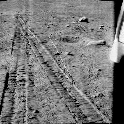
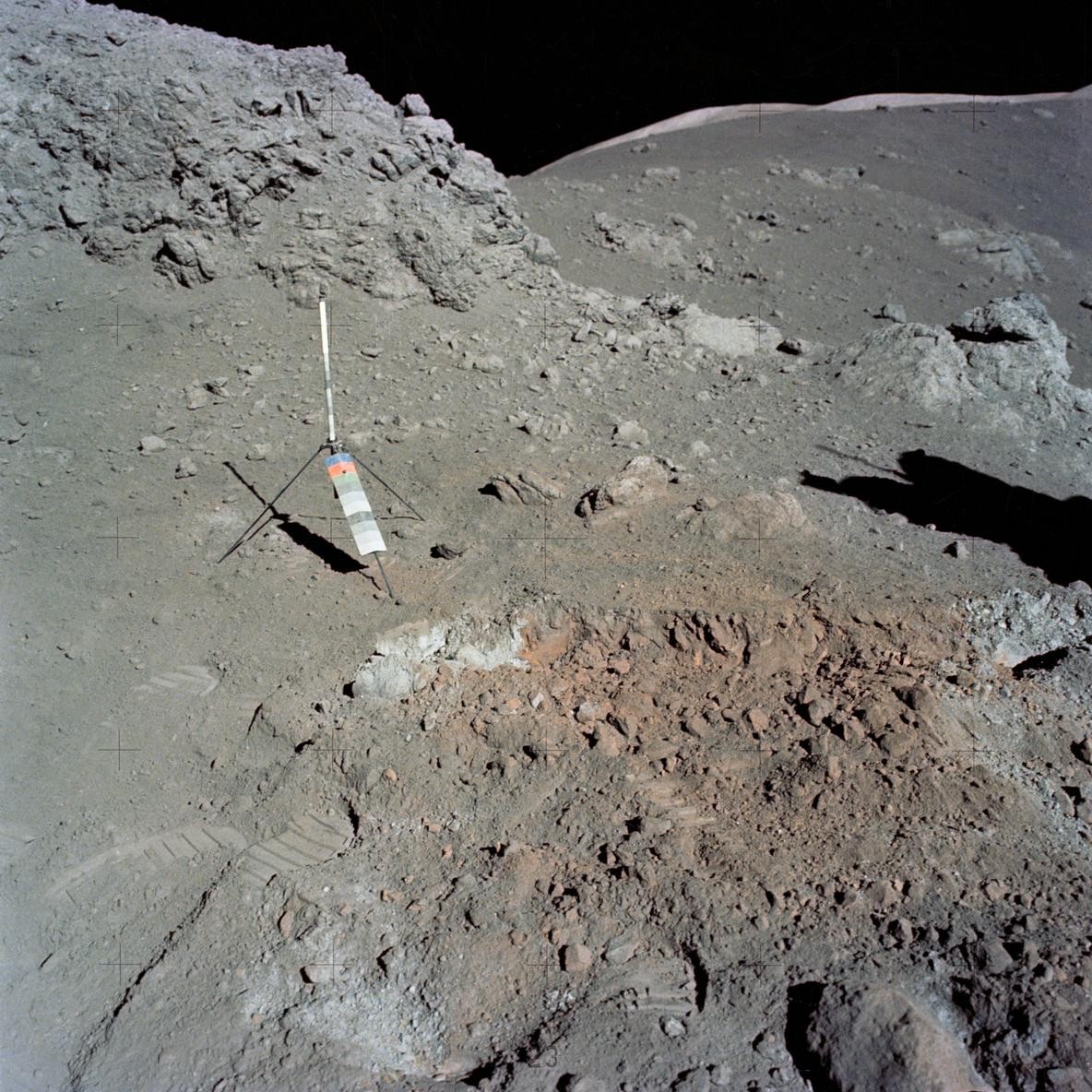
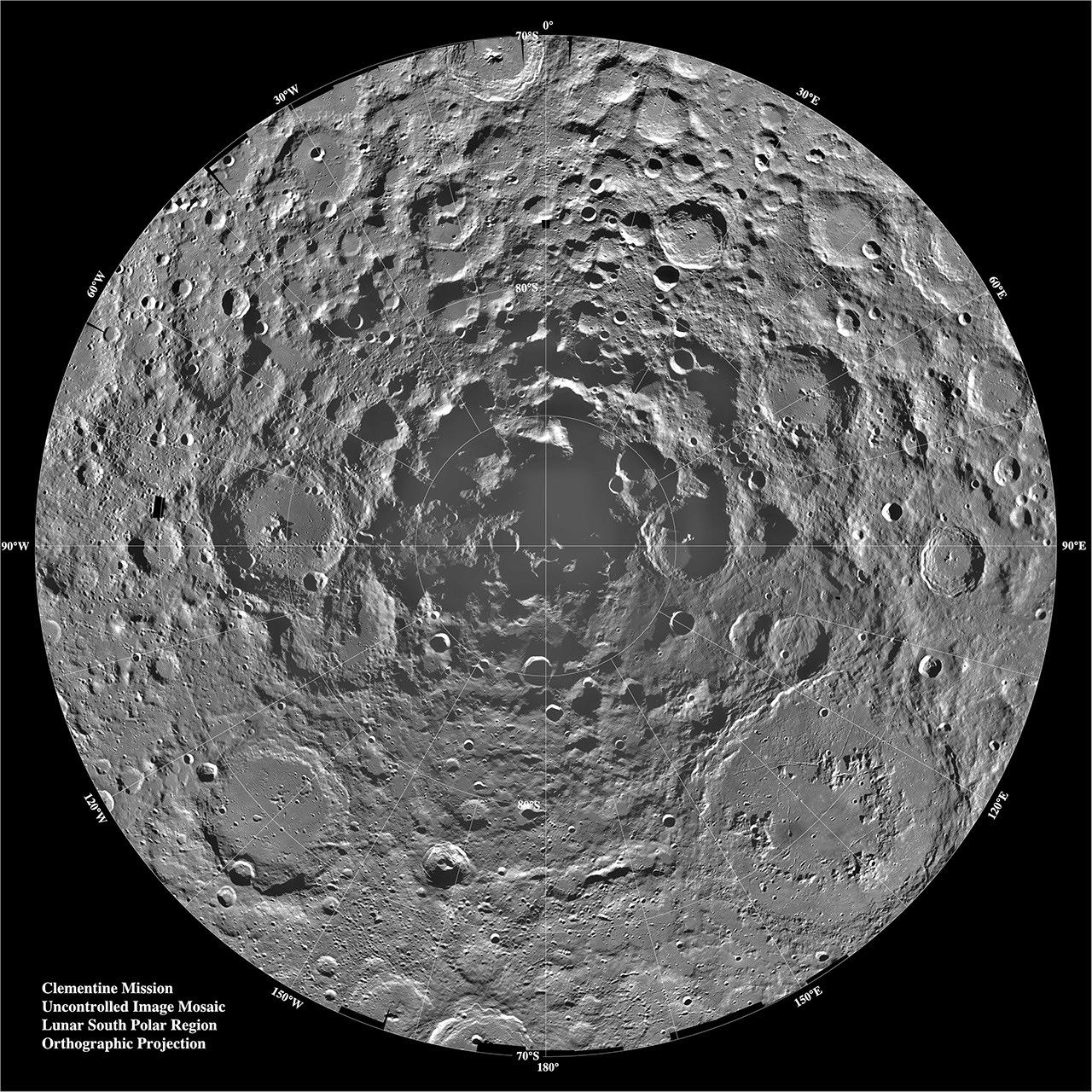
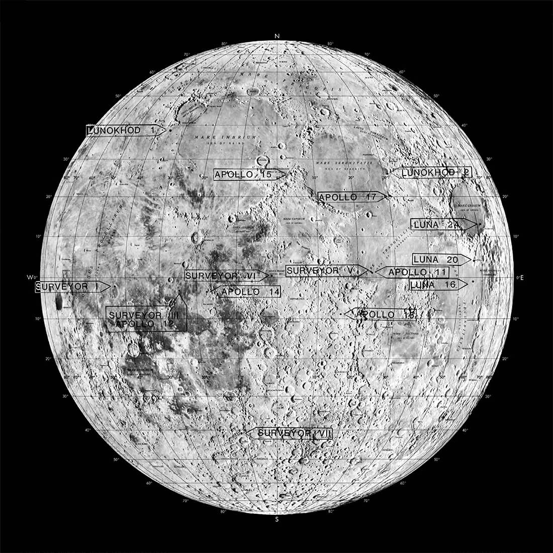
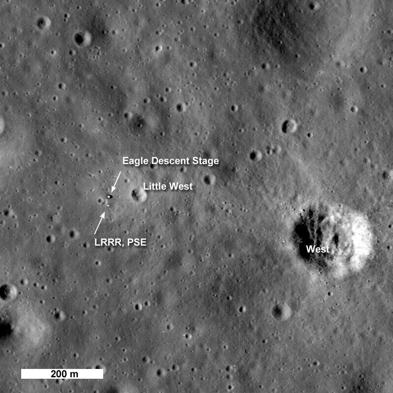
Explore our interactive photo gallery to see how nearly 70 years of Moon photography has changed the way we see our nearest celestial neighbour.
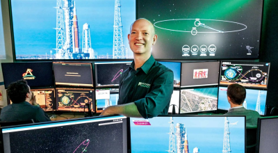
Expand The first image of the lunar farside photographed by the former-USSR’s Luna-3 in 1959. Credit: NASA

From the Earth, we only ever see one face of the Moon, due to its “tidally locked” orbit.  The lunar farside was a complete mystery until the first spacecraft could reach the Moon and send back images. On 7 October, 1959, the former-USSR’s Luna-3 spacecraft returned the first views ever of the far side of the Moon, as it flew past at a distance of about 63,500 kilometres.  

This grainy, noisy image was the first of 29 photographs taken by Luna-3, covering 70 percent of the farside. It surprised astronomers by being so different to the visible nearside, lacking in maria (“seas”) and very heavily cratered. 

Credit: NASA

Expand The first close-up mage of the Moon’s surface, taken by Ranger-7 as it descended towards the Moon in July 1964.  Credit: NASA

On its historic mission, Artemis II carried a copy negative of a photograph of the Moon’s surface taken on 31 July, 1964, by NASA’s Ranger-7 mission. Designed to provide close-up images of the Moon’s surface ahead of the Apollo missions, the Ranger program suffered repeated failures until Ranger-7 made the first controlled impact onto the lunar surface, sending back images as it plummeted from space. 

During its final 17 minutes of flight, Ranger-7’s six vidicon television cameras transmitted 4,316 pictures back to Earth, with the final image captured just 300 metres above the lunar surface. These pictures showed that the lunar surface was more heavily cratered than expected at small scales.

Credit: NASA

Expand Lunar Orbiter-1 photo of the lunar farside, with the Earth visible in the background, and the dark-floored Tsiolkovsky crater in the upper left.  Credit: NASA

The five spacecraft of NASA’s Lunar Orbiter program mapped the Moon in detail during 1966-67, assisting scientists to identify safe landing sites for the Apollo astronauts. The program produced several images that were considered iconic. 

Lunar Orbiter-1 snapped the first image of the Earth taken from lunar distance. It shows the Earth above the horizon, with the farside below, and the dark-floored crater Tsiolkovsky (named for one of the great pioneers of astronautics) prominently visible. Another Lunar Orbiter image, a dramatic oblique view of the crater Copernicus, was dubbed “one of the greatest pictures of the century” when it was originally released.

Credit: NASA

Expand : Mosaic of images taken by Surveyor-1, creating a view of part of the spacecraft, its shadow on the Moon and the lunar surface.  Credit: NASA

In the early 1960s, there was concern that the Moon’s surface might be covered in a layer deep dust that would swallow up any spacecraft landing on it. NASA’s Surveyor program was intended to confirm that astronauts could land safely on the lunar surface. Between 1966 and 1967, five Surveyor craft landed successfully in regions being considered for Apollo landings. 

They carried several instruments, including a soil scoop, to test the characteristics of the lunar surface, as well as a sophisticated camera. The Surveyors returned more than 80,000 surface images with resolution down to millimetre-level. These pictures could be mosaiced together to form wide area views of the landing site. Apollo-12 landed close to Surveyor-3 and the crew visited it during their Moonwalk. 

Credit: NASA

Expand Lunokhod-1 looks back across its wheel tracks after an excursion into a crater on the Moon.

Trundling across the Mare Imbrium (Sea of Rains), the USSR’s Lunokhod-1 (the name means “Moon walker”) explored a part of the Moon away from the Apollo landings. Remotely-controlled by a team of drivers on Earth, Lunokhod-1 was the first robotic vehicle to explore the Moon, travelling a distance of 10.54km across the surface between November 1970 and September 1971. 

It returned more than 20,000 TV images and 206 high-resolution panoramas, performed 25 lunar soil analyses with its x-ray spectrometer and used its penetrometer at 500 different locations. Lunokhod’s French-supplied laser retro-reflector is still in use today to measure the distance between the Earth and the Moon.

Credit: Russian Academy of Sciences

Expand Orange soil on the Moon, discovered during the Apollo-17 mission Credit: NASA

During the Apollo program, astronauts exploring the lunar surface could take close of images of interesting surface features, to help geologists back on Earth better understand the Moon’s geological history. One of the most unexpected discoveries was orange soil, found during the Apollo-17 mission in December 1972 by geologist-astronaut Dr Harrison Schmitt. 

This is the advantage of having astronauts exploring the Moon in person in future Artemis missions. Trained scientists will recognise unique features that rovers and static landers might miss. They can also set up scientifically useful photographs like this Apollo-17 image for researchers back on Earth.

Credit: NASA

Expand A composite view of the lunar south pole showing the permanently-shadowed craters where lunar ice was first detected.  Credit: NASA

In 1994, the Clementine spacecraft spent over two months mapping the geology of the Moon at visible and infrared wavelengths. NASA’s first lunar mission in twenty years, Clementine made the initial discoveries that led to the lunar South Pole region being targeted as the landing site for future Artemis missions. 

Returning more than 1.6 million digital images, Clementine data gave early hints that the Moon’s polar regions could contain ice deposits at the bottom of permanently-shadowed craters.  The images also showed elevated regions near the poles that would remain in near perpetual sunlight, providing a source of solar energy for future explorers. 

Credit: NASA

Expand False-colour image showing the presence of radioactive Thorium on the lunar nearside. Lunar Prospector data has been visualised, mapped onto an image from the Clementine mission.  Credit: NASA

Ice on the Moon could provide sources of water and rocket fuel for future exploration. NASA’s Lunar Prospector orbited the Moon for 19 months in 1998-99. It did not carry any cameras, but its suite of six instruments mapped the Moon’s surface composition in several wavelengths, complementing the visual imagery from the Clementine mission.

It found indications of hydrogen deposits at both poles, suggesting the presence of ice, or water bonded to minerals.  Prospector also measured lunar magnetic and gravity fields. Its data contributed to better understanding of the Moon’s origin, evolution, and available mineral resources. 

Credit: NASA

Expand The blue tone in this is false-colour image from a NASA instrument on India’s Chandrayaan-1 mission indicates the presence of water in the Moon’s polar regions. Credit: NASA/ISRO

In late 2008, India became the fifth to reach the Moon, after the former-USSR, USA, ESA and Japan. By the time its Chandrayaan-1 mission launched, instruments on other space missions, and further analysis of Apollo samples, had given more hints of water on the Moon. 

Chandrayaan-1 carried instruments from several countries, and a small impactor probe, to improve understanding of the Moon’s physical characteristics, map the minerals on its surface and search for water. Indian and NASA instruments finally confirmed the presence of water – not just at the lunar poles, but also as vapour in the Moon’s very tenuous atmosphere. 

Credit: NASA/ISRO


Expand LRO high-resolution view of the Apollo-11 landing site, showing the lower stage of the Eagle Lunar Module and some of the instruments left on the Moon by Armstrong and Aldrin. Credit: NASA

Reaching the Moon in mid-2009, NASA’s Lunar Reconnaissance Orbiter (LRO) is the longest-lived lunar orbiting mission to date. LRO has helped to identify areas near the Moon’s south pole with the crucial resources of water and extended sunlight which are vital to planning for the Artemis program, and also for Australia’s solar-powered Roo-ver rover, due to land in 2030. 

LRO has mapped the Moon’s surface environment in unprecedented detail, refining our understanding of the Moon’s temperature, composition, and radiation environment. Its high-resolution camera was the first to image the Apollo landing sites from orbit with enough resolution to clearly see the landing hardware, rovers, and other equipment.

Credit: NASA

Expand The Artemis-I Orion spacecraft takes a selfie with the Moon and the Earth in the background. Credit: NASA

Artemis-I was an uncrewed test flight of the Orion spacecraft in preparation for the Artemis-II mission, in which astronauts would return to the Moon for the first time since Apollo. Across 25 and a half days in November-December 2022, the Artemis-I mission tested the systems and endurance of the Orion to ensure that it was ready for a human crew.  

On flight day 13, Orion reached its maximum distance from Earth at 432,210 kilometres, breaking the distance record for any spacecraft designed to carry people. A camera mounted on one of the Orion’s solar panels took this historic view of the Moon and the Earth. 

Credit: NASA

Expand This breathtaking image of the Moon eclipsing the Sun was taken by the crew of Artemis-II during their historic lunar flyby. Credit: NASA

In April 2026, the Artemis-II crew became the first astronauts to return to the Moon since 1972. During their loop around the Moon on 6 April, they experienced an “artificial” eclipse of the Sun: from their perspective, the Moon appeared large enough to block the Sun, creating a total solar eclipse that lasted for nearly 54 minutes. 

While in darkness, the astronauts were able to see brief flashes created by meteorites striking the lunar surface. This had not been anticipated and demonstrates the value of humans in space exploration, able to see and comprehend things a robotic system might miss. 

Credit: NASA

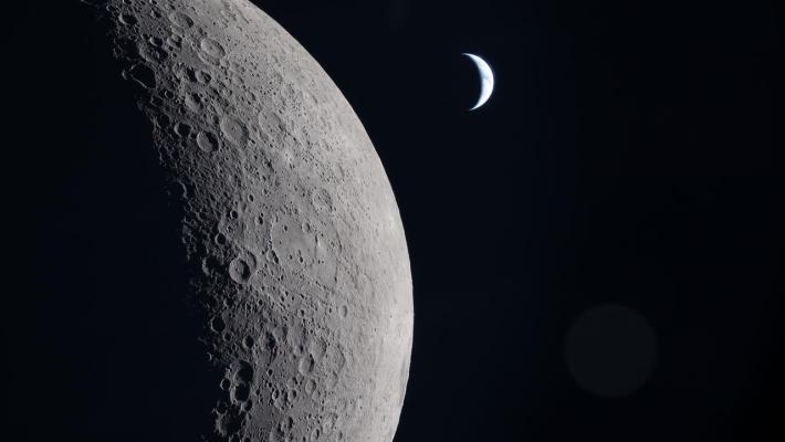
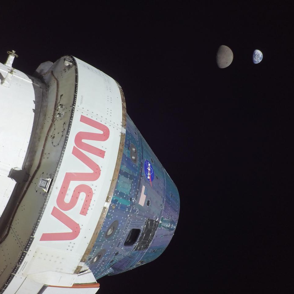
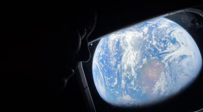
Main image caption: As the Artemis II crew came close to passing behind the Moon and experiencing a planned loss of signal, they captured this image of a crescent Earth. 

Seen from afar, it almost looks like a circular arc – except when backlit, as in other images captured by the Artemis II crew. Earth is in a crescent phase, with sunlight coming from the right. The dark portion of Earth is experiencing nighttime. 

Credit: NASA

Latest from the Australian space sector

Our department recognises the First Peoples of this Nation and their ongoing cultural and spiritual connections to the lands, waters, seas, skies, and communities.

We Acknowledge First Nations Peoples as the Traditional Custodians and Lore Keepers of the oldest living culture and pay respects to their Elders past and present. We extend that respect to all First Nations Peoples.

Back to top